Istanbul, Turkey’s largest and most populous city, spans both Europe and Asia. Istanbul’s urban area covers approximately 2,576.85 km² (994.93 square miles), placing it among the world’s largest cities in terms of surface area. This expansive urban landscape is home to 15,815,231 people (as of 2024), so population density (urban) is about 6,137/km2 or 15,896/square miles.
However, the city extends even further when considering its entire metropolitan area, which encompasses 5,343.22 km² (2,063.03 square miles).
A stunning view of Istanbul from space, taken by NASA astronaut Randy Bresnik from the International Space Station on December 10, 2017. Sharing the photo on Twitter with the message ‘Günaydın İstanbul’ (Good morning, Istanbul), Bresnik captured the city’s breathtaking morning light. The image showcases the vast expanse of Istanbul, which spans both Europe and Asia, with the Bosphorus Strait, the Sea of Marmara, and the Black Sea clearly visible. Southeast is up. This photo gives a clue as to how large a city Istanbul is.
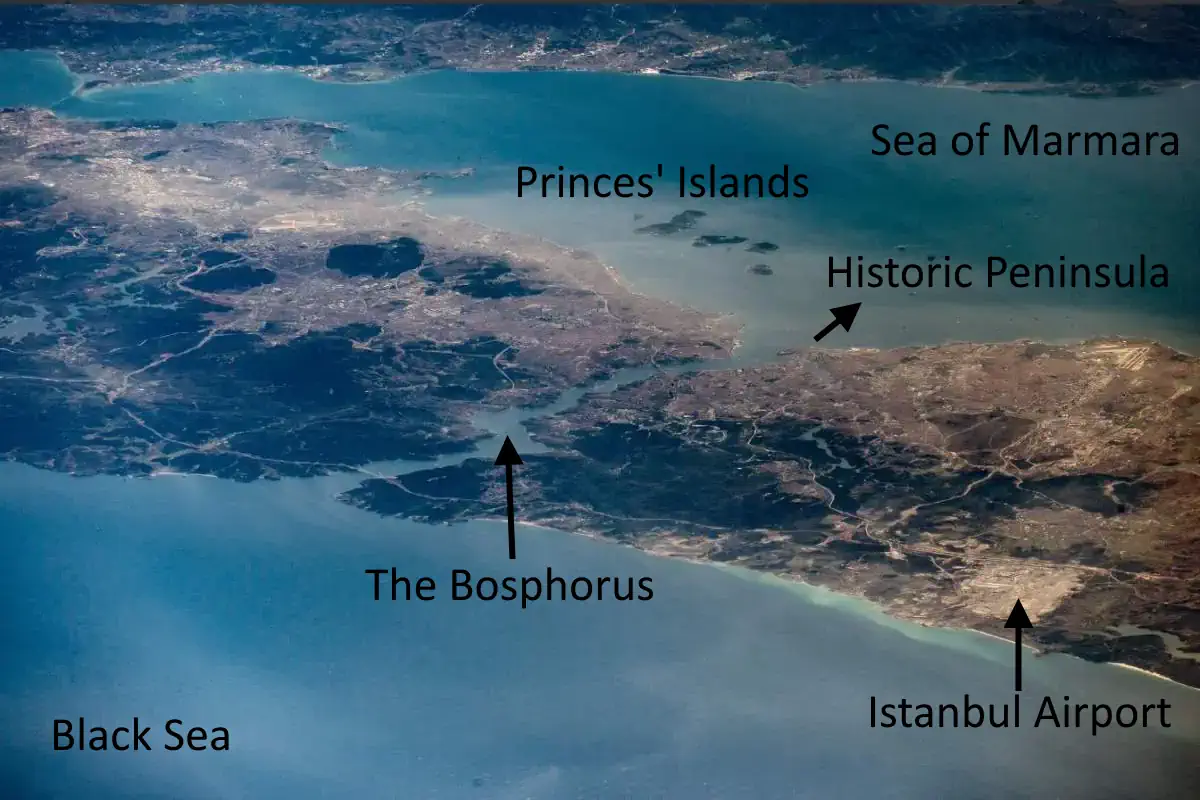
Here is the annotated version of Bresnik’s photo: Please note how the historic peninsula, which was once “Istanbul” (Constantinople) itself, is now barely distinguishable amidst the vast ocean of massive Istanbul buildings.
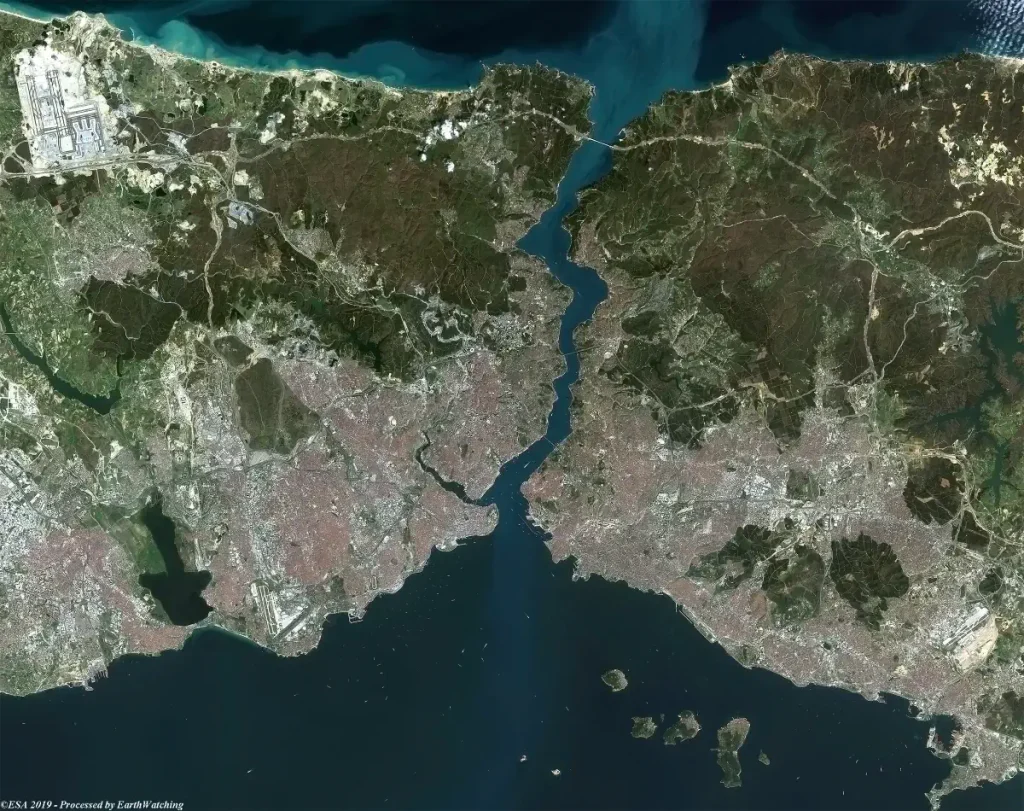
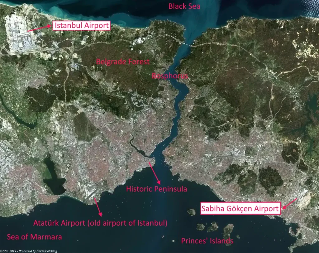
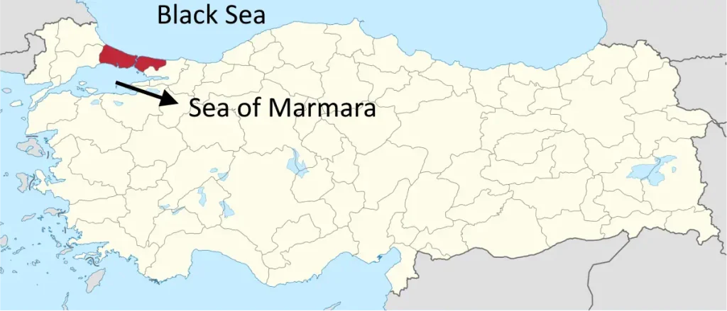
Istanbul from space, December 10, 2017 (annotated version). The Black Sea, the Bosphorus, the Princes’ Islands (the word “princes” is plural, because the name means “Islands of the Princes”, Greek: Πριγκηπονήσια, Pringiponisia), the Sea of Marmara, the Historic Peninsula, and Istanbul Airport are marked. Back in 2017, Istanbul Airport was still under construction. The official opening ceremony took place on 29 October 2018, and all passenger services fully commenced on 6 April 2019.Another stunning photo of Istanbul from space, taken in 2019 and published by the European Space Agency (ESA). This image offers a glimpse of the vastness of Istanbul. At the northern edge of the Bosphorus, you can spot the Yavuz Sultan Selim Bridge, which opened on August 26, 2016. The bridge spans 2,164 meters (7,100 feet). Additionally, Istanbul Airport, which was operational at the time of the photo, is visible as well. North is up.Istanbul from space (2019), the annotated version of the photo above. Marked on the image are Istanbul Airport, the Black Sea, Belgrad Forest, the Bosphorus, the Historic Peninsula, Sabiha Gökçen Airport, Atatürk Airport (the former main airport of Istanbul), the Princes’ Islands, and the Sea of Marmara.The province of Istanbul is marked with red on the map of Turkey. Its metropolitan area encompasses 5,343.22 km² (2,063.03 square miles). Image by TUBS – This vector image includes elements that have been taken or adapted from this file: CC BY-SA 3.0, Link
Özgür Nevres
I am a software developer and a science enthusiast. I graduated from Istanbul Technical University (ITU) with a degree in Computer Engineering. I write about the city of Istanbul on this website. I have lived in Istanbul since 1992. I am also an animal lover! I take care of stray cats & dogs. The income from this website goes directly to our furry friends. Please consider supporting me on Patreon [by clicking here] or on Buy Me A Coffee (Of course, you won't buy me a coffee, you will buy food for stray animals!), so I can help more animals!